I spent 2009 living, working, and traveling in Nevada and I can tell you that it is a state that has much more to offer than most people think. It is a surprisingly good place to ride a bike and the following photographs are only a small taste of what Nevada is all about.
Las VegasCycling probably isn't one of the first things that comes to mind when you think of Las Vegas, but that will change if you do some riding in the area. I lived in Vegas for the first third of 2009 and it is actually a relatively bicycle-friendly place. The roads are smooth, there is a decent bike lane network, and the weather is fantastic. My number one complaint would be that the air quality could use a little help.
If you don't feel like riding in the city, Las Vegas is surrounded by 3 great places to ride. From left to right on the map below they are: Mt. Charleston, Red Rock Canyon, and Lake Mead National Recreation Area.

L-R: Mr. Charleston, Red Rock Canyon, Lake Mead
Let's start with Red Rock Canyon. If you ask any local where you should ride if you come to Las Vegas, he will tell you to head to Red Rock Canyon, home of a ~15 mile scenic loop where you will see red rocks like this:

Red Rock Canyon

Red Rock Canyon

Red Rock Canyon

Red Rock Canyon

Red Rock Canyon

Red Rock Canyon

Red Rock Canyon

Red Rock Canyon
If you want to add on some extra miles, Highway 159 has a very wide shoulder and is popular with cyclists. For my first Nevada century, I went from Las Vegas to Red Rock Canyon and added on extra miles on 159 and 160. Here are some scenes from that ride:

Smooth road, plenty of shoulder, and great views. I love it.


"Begin Scenic Route" indeed!

If you look closely you can see the Las Vegas in the distance.
Lake Mead is another fantastic place to ride. I was living on the east side of Las Vegas, so it was an easy ride over there when I wanted to get away from the traffic and ride in peace. This is about the easiest century you can do. Just hop on 167 and enjoy.

LMNRA: Smooth roads, low traffic, good shoulder.

Lake Mead in the distance.
When you feel like climbing, head to Mt. Charleston. There are two ways to do the climb, so you shouldn't get bored. If you start at the green arrow pictured below, it is a 21-mile climb, but not as steep. If you climb it the opposite way, it's shorter at 17 miles, but steeper. One of the centuries I did was from Vegas out to Mt. Charleston and back.

Here's the meat of the Mt. Charleston century I did.

The elevation profile. It's a long climb, but stars off fairly easily.

Mt. Charleston in the distance.

Getting closer.

Not your typical Las Vegas scenery.

This is a wonderful sign to see!
RenoAfter winter was over I landed in Reno, which ended up being a perfect situation. Reno is a relatively small city that is very bicycle friendly. There are plenty of bike lanes and its small size allows you to find a good route with light traffic to pretty much anywhere you want to go. The best thing about Reno is its proximity to some of the best riding in the country. (If you stay for the winter I hear the skiing is pretty good in Tahoe, too.) On the map below working clockwise you'll see Pyramid Lake to the North, Geiger Grade to the east, and Mt. Rose to the west. All of these are easy to reach by bike from Reno. Northern California, which is my favorite place I've ridden so far (see my entry on California), is a short drive away.

Clockwise from top: Pyramid Lake, Geiger Grade, Mt. Rose.
Geiger Grade
Geiger Grade is a 7.8-mile climb with about 2,000 feet of elevation gain. This became my favorite training ride in Reno, a place where I could test my fitness on a regular basis. It can also be a gateway to some longer riding by going through Virginia City to US 50, the "Loneliest Road in America". It can also be added to Mt. Rose and 6 Mile Canyon Rd. for a nice day of climbing.

Geiger Grade's elevation profile.

Geiger Summit. The elevation is easy to remember: 6,789.
Mt. Rose
Mt. Rose (from Reno) is a longer, more scenic climb of 16.3 miles and ~4,200 feet. This climb is the gateway to the beauty of Lake Tahoe. After you reach Mt. Rose Summit, you can descend the other side of Mt. Rose highway and catch your first glimpses of Lake Tahoe. What could be better? Once you reach the bottom, you can continue either direction on 28, which will take you around the perimeter of Lake Tahoe. Traffic can be busy here, but the views are worth it!
Mt. Rose Summit is also home to a hiking trail that goes to the top of Mt. Rose, which tops out at 10,776 feet. The hike is about 10.5 miles as a round trip and gains almost 1,900 feet. One day I decided to "conquer" Mt. Rose under human power, so I rode to the Mt. Rose Summit and hiked to the top from there. All together I climbed ~6,000 feet and had a wonderful time. The views of Lake Tahoe from the top are spectacular.

Elevation profile for Mt. Rose. Never too steep, but long.

My bike and the summit. Straight ahead is a nice descent with views of Lake Tahoe.

Descending Mt. Rose Hwy.

A look at Mt. Rose from 395 as I was about to ride/hike to the top.

A look at me and Reno from my Mt. Rose hike.

Lake Tahoe from the top of Mt. Rose (10,776 feet).
Pyramid Lake was my century of choice when I didn't feel like doing much climbing. The route is a simple out-and-back, mostly along 445, that has more of a high desert feel to it. The roads are nice and quiet, giving you a chance to just relax, take in the scenery, and enjoy the ride.

The route is a simple out-and-back.

A glimpse of Pyramid Lake.

A few trees changing color in the fall.

Why did the snake cross the road?
(Edit: This is the original post as I wrote it in early 2010 while living back in Indiana for what I thought was going to be a while. As of late 2010 I live in Reno for good. I couldn't be happier.)
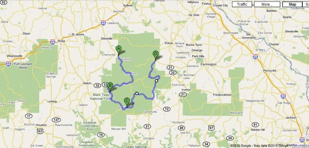 Here's my route map in Mark Twain National Forest. Compared to national forests out west, this doesn't seem like a national forest at all. Most of it just seemed like any old country road you'd expect to see in rural MO. Nevertheless, it was a very nice route.
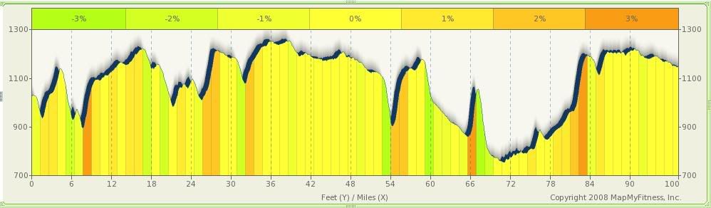 Tons of rolling hills + twisting & turning roads = never a dull moment. The time was flying and I was having fun.
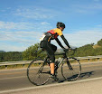
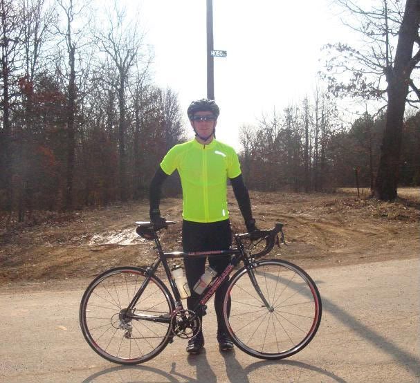 Looking ugly before the ride.
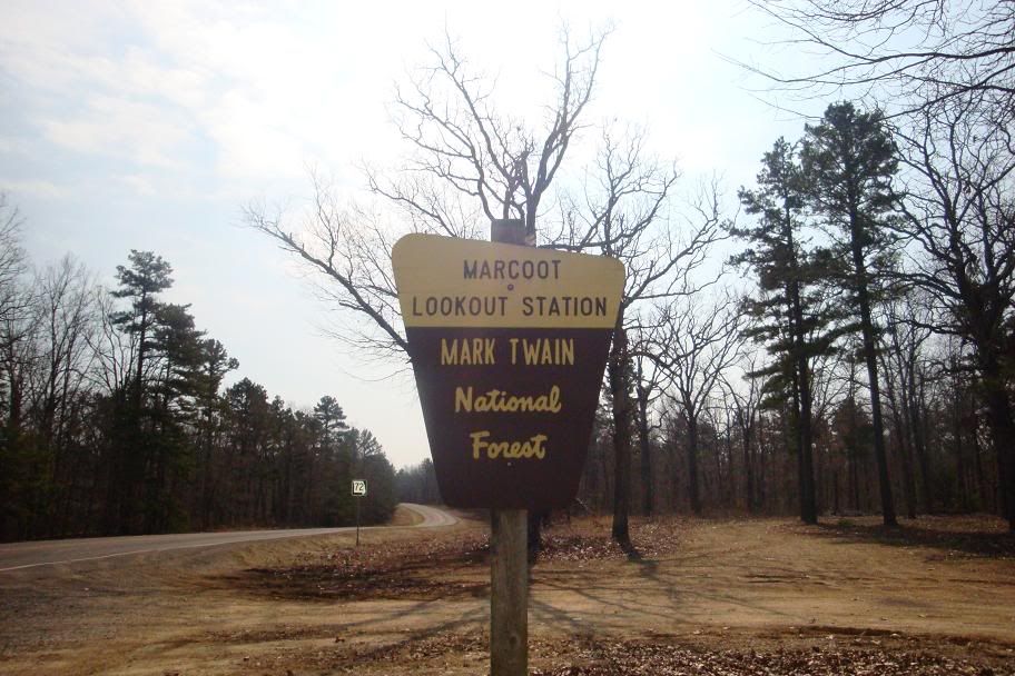 Mark Twain National Forest.
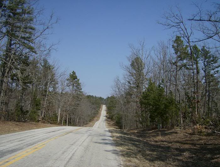 Just a taste of some of the rolling hills you can expect if you come ride here.
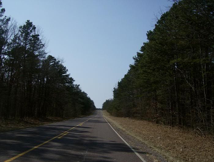 This part actually looked like a national forest.
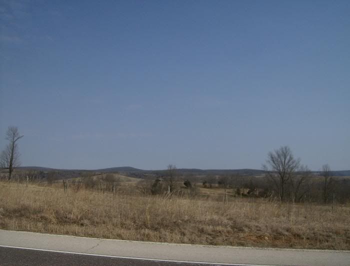 The countryside.
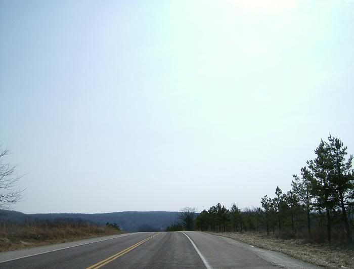 Up...
Up...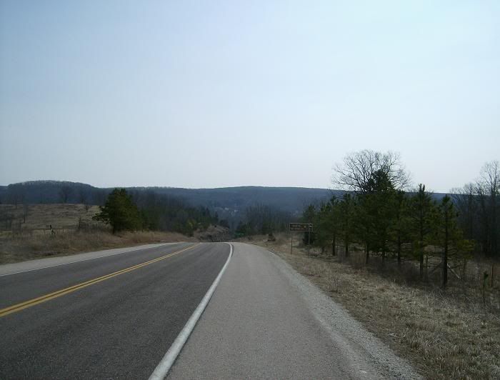 ...and down.
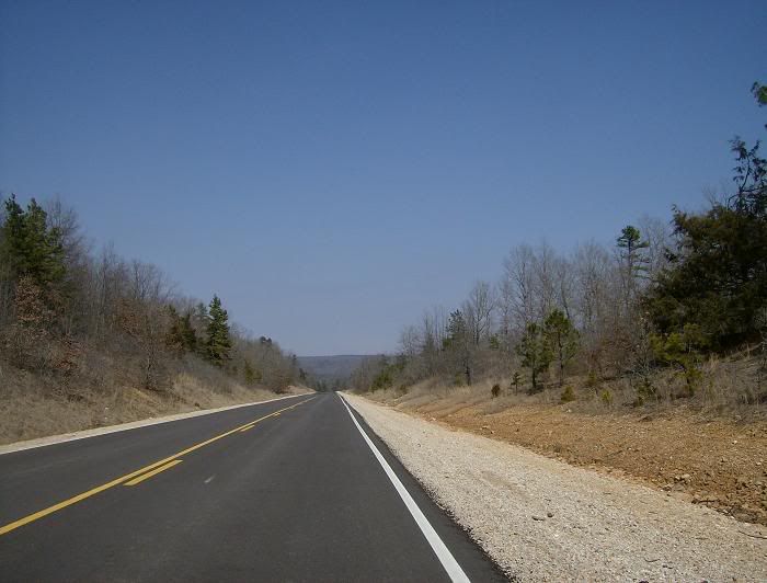 The roads were in good shape for the whole route.