Monday, December 15, 2014

Arkansas

In August of 2014 I took a short trip and rode 3 states in 3 days. This was the third day of that trip.


I started the ride at the Cove Lake campground, which is in the western portion of the state.

Cove Lake Campground, Arkansas
The Arkansas century route
The Cove Lake Campground was great. There was hardly anybody there and I got a nice spot right next to the water.

My spot at Cove Lake Campground
The plan for the day was to ride about 35 flat miles towards Dardanelle, tackle Mt. Nebo, then ride another 40 flat miles and tackle Mt. Magazine. However, when you're a dumb guy like me, things never quite go as planned.

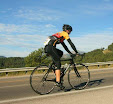
I thoroughly enjoyed the first 35 miles to Dardanelle. I actually managed to get an early start on the day, so temperatures were cool, traffic was light, and everything seemed calm and relaxed. My legs weren't feeling too bad (the 2nd day is always worse than the 3rd for some reason), either.

Mt. Nebo was a killer little climb: 2.5 miles at 10%. It starts out difficult with some super steep switchbacks, then it eases off for a little flat section before it kicks up again towards the end. There's a nice park at the top with a few campsites (water!) and a pool. There was some kind of running race going on while I was there, so the place was packed. I wish I had more time to explore the park, but I had other plans for the day.

After Nebo it was on to Mt. Magazine. What I didn't realize was that my route took me on a short gravel climb to get there. I thought I did my research on Google Maps with satellite view and street view, but obviously I missed something. My GPS was telling me to turn on the gravel road, but for some reason I wasn't trusting it. I even went 3 miles in the wrong direction before I broke free from my denial and turned back towards the dirt road. There really wasn't another option that didn't add a lot of extra mileage, so I took the dirt road and hoped for the best.

As luck would have it, the dirt road wasn't all that bad. According to Strava there's a section of 0.7 miles at 7%, but the surface was good enough that I was able to keep traction on my road bike. I took it slow on the descent and everything was fine. These kind of things are annoying when they happen, but once they're done they're over you're glad they happened. They add an extra element of excitement to the ride.

Mt. Magazine was a good climb. My legs were tired at that point so I wasn't exactly flying, but the scenery was great and there was hardly any traffic out there. There's an easier section towards the top of the climb and then it was mostly downhill back to Cove Lake Campground.

All in all it was a great day to ride a bike and a good way to end my trip. After 3 days I was finally getting used to the humidity, so it was a shame that I didn't have more time to ride and explore the area. I definitely hope to return to Mena and ride more of the Talimena Byway. I'm sure there are other nice areas that Arkansas has to offer. As always, it's difficult to pick one route in a state and feel satisfied that you know what the state is all about.

Update: I rode across the southern portion of Arkansas during my 2015 ride across the country. Here are the relevant days:  16, 17, 18. You can find more pictures there, plus the Strava links for all routes.

Oklahoma

In August of 2014 I took a short trip and rode 3 states in 3 days. This was the second day of that trip.

Strava Link


The ride was in Poteau, OK, which is in the eastern portion of the state.

Poteau, OK

OK route

The day started with the Cavanal climb, which is 3.4 miles at 9%. It manages to reach that 9% average despite a downhill section midway through the climb. I thoroughly enjoyed the climb. It was early in the day and wasn't super hot yet, but I was still soaking with sweat when I made it to the top. There was a nice viewpoint area at the top, which must be a really nice place to visit in the Fall.

After Cavanal, I made my way through some flat country roads towards the Talimena Scenic Byway. The plan was to take the Byway over to 259, then take 250/59 back to Poteau. However, I was having trouble adjusting to the heat and humidity. I'm used to the heat (high of 99), but the humidity (~50%) was killing me. I was drinking a lot more than normal and couldn't find anywhere to get water. The good thing about scenic routes is that they're scenic. The bad thing is that it can be difficult to find water.

There was a funny moment when I turned from 271 on to the Talimena Byway. I was dying for water at that point and right at the corner is a welcome center with restrooms and water fountains. Unfortunately, the welcome center must not be in the budget anymore as the bathrooms were closed and the water fountains were turned off. It all seemed like a cruel trick.

I continued on Highway 1 for a little while, and a few miles down the road was an area with restrooms. Those were just pit toilets and there was no water to be found. I was 20 miles of up-and-down road away from Highway 259, and even if I made it to 259 who knows how far the next water source would be from there. I was already feeling the effects of dehydration, so I made the decision to turn around and head towards Talihina, which was about 8 miles away. It turns out that Talimena State Park was only about 2 miles away, and I got water there.

I just rode the 30 miles straight back to Poteau on Highway 271 from there. Fortunately, 271 wasn't all that busy and actually had a shoulder most of the way. Physically I didn't feel all that great, but at least I knew that water was never too far away. I was drinking at least 2 bottles an hour, which is a lot for me. The most I'll drink at home in Nevada is 1 bottle an hour, and that's on hot days with lots of climbing.

It was a shame that I had to skip the best part of the ride, but I still enjoyed Oklahoma. The Cavanal climb was a nice, difficult little climb and I enjoyed the quiet roads outside of Poteau. I hope to make it back some day so I can ride the whole Talimena Scenic Byway.

At the top of Cavanal Hill
A view from the top of Cavanal. It's too bad it wasn't a clear day.


Update: I rode across a large portion of Oklahoma during my ride across the country in the summer of 2015. Here are the relevant days: 13, 14, 15, 16. You can find more pictures there, plus Strava links to the route I used.

Kansas

In August of 2014 I took a short trip and rode 3 states in 3 days. This was the first day of that trip.


The ride was based around the Flint Hills National Scenic Byway near Council Grove, KS. Here is Council Grove on the map.

Council Grove, KS
The route was a simple out-and-back from the Canning Creek Campground to 177, past the Tallgrass Prairie National Preserve, out to about I-35 and back again.

KS Route
There were a few rolling hills, but nothing major. They did more to add to the scenery than to make the ride difficult. Total climbing for the day was around 2,500 feet. The bigger challenge was the wind- a steady 15-20mph. The good news is that it was from the south, so there was a headwind on the way out and a tailwind on the way back. Heat was a factor with a high of 97 degrees, but the wind made it feel cooler than that and the next two days in OK and AR were much worse.

Canning Creek Campground was great. I stayed on a Wednesday night and pretty much had the whole place to myself. It was right by the water, but bugs weren't a factor. Perhaps the wind scared them off. I was able to sleep in the grass without setting up my tent. The wind was blowing hard all night, which was good for sleeping but an ominous sign for tomorrow.

Canning Creek Campground
The ride to the Scenic Byway was nicer than I expected. It started out with a nice ride over a bridge and took me through Council Grove, which was a quiet little town that was fun to see in the morning when nobody was around.


The Byway itself was great. The scenery was good, the road surface was smooth, and there wasn't much traffic.

The first small hill of the day


Tallgrass Prairie National Preserve